What can stay, and what needs adding? Working devices can remain data sources when their interfaces fit. Shared Pi services connect data and functions; native Android apps provide the control positions. Device models, desired functions and installation locations determine your boat’s specific setup.
Start with the task, then the shopping list.
Record what is already installed and what gets in your way during use. Adding a display does not automatically mean replacing a working depth instrument. Reusing its data depends on the particular model and available outputs.
- Device models, software versions and documented connections, such as NMEA 0183, NMEA 2000 or SeaTalk.
- Desired functions and control locations: helm, chart table, second seat or a dedicated control.
- Space, viewing angle, sunlight, water exposure, existing power and accessible cable routes.
One component can make the difference.
For instruments at the helm, start with Signal K, suitable adapters and HELM. MAP adds local chart rendering on Android. For audio, the Pi remains the playback and processing centre while displays provide the controls. Choose the starting point that helps your boat today.
An extra control position uses the same services over the boat network. Our two-device test demonstrates this with the confirmed master-volume setting. The functions available on an additional device are determined by its specific integration.
The display needs to fit its location.
My examined Lumina/K706 cost €75. It runs the native apps and local chart rendering shown here. That price covers one display; computer, power, adapters and installation depend on your chosen setup.
For a cockpit, readability at the intended location, protection, controls and mounting are important selection criteria. Our device captures show the actual interface. The display case study also covers firmware, buttons, rotary controls and startup. A sunlight measurement is different from an indoor capture.
Plan chart storage and data connections separately.
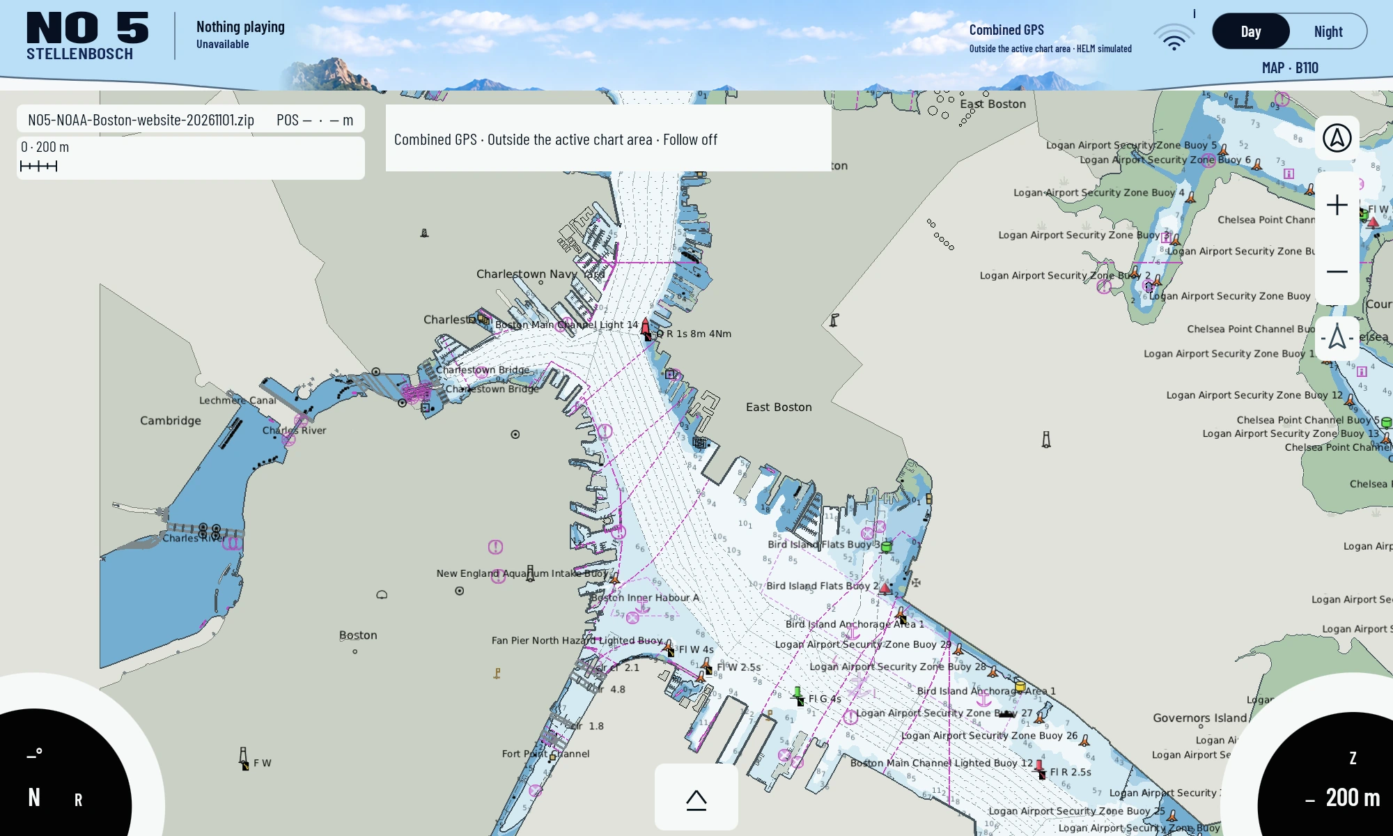
MAP renders imported marine charts locally on the device. The Boston demonstration uses four existing NOAA cells. Available charts for your cruising area depend on source, format, coverage and usage rights. Updates and chart costs therefore belong in the plan as separate items.
The local boat network connects displays and services. A later cellular connection can support maintenance and additional services. Boat monitoring, battery or bilge data and Home Assistant are possible extensions requiring suitable sensors and a specific integration.
Build it yourself or bring in the skills you need.
Implement the software and hardware yourself, or share printing, board fabrication, assembly and installation across different people. Published sources, variants and connection data provide the shared foundation. A fabricator also needs actual dimensions and conditions aboard your boat.